Features CamGNSS
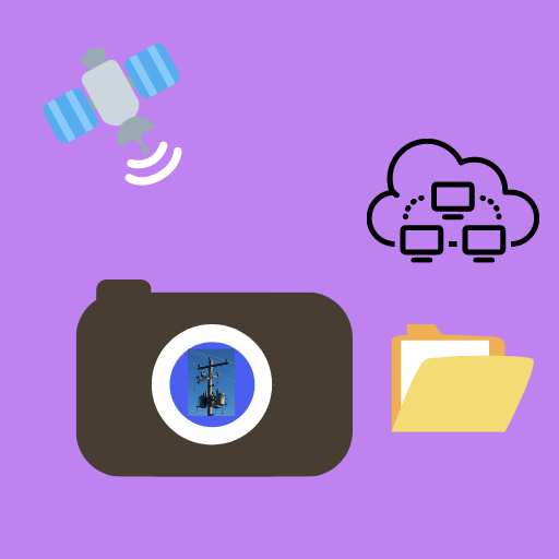
CamGNSS is an ultra-low-cost solution for capturing photos with centimeter-level positional accuracy, right on your mobile phone.As the name indicates, CamGNSS integrates the camera of your mobile device with the multiband GNSS receiver, set up in a rover and base configuration.
The app is currently compatible with u-blox ZED-F9P or its application boards.
In the absence of a GNSS receiver, the app uses the mobiles built-in GPS.
You may not achieve centimeter-level positional accuracy with GPS; however, all other features of this app function exactly the same way in both GNSS and GPS modes.Since youre using your own mobile device, you get to choose the camera resolution and camera settings that best suit your requirements.
In other words, you are not constrained to use the low-resolution built-in camera of your GNSS rover.Key Features:1.
Connects with u-bloxs multiband GNSS chipset ZED-F9P in a rover and base configuration, allowing you to pick survey points with centimeter-level positional accuracy just by taking photos.
2.
The app recognizes and reads text within the images you capture and adds the text to the image description.
You can toggle this feature on and off in settings.
The free version of CamGNSS has a limit on text recognition.
Install CamGNSS Pro for unlimited text recognition.3.
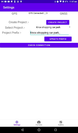
The app groups and saves images in folders by project name and renames each image with a prefix based on the asset class you provide.
This feature can save a lot of time in organizing and classifying the images by asset class.
The date and time the image was taken are included in the filename as a suffix.4.
When selected in settings, the app prints coordinates on your images.5.
You can measure linear distances between images within the app.
We recommend relying on this feature in GNSS mode.6.
The most important feature of CamGNSS is its seamless integration with our cloud-enabled GIS cataloguing platform, "Ylobe." You can upload the images captured in the field and instantly switch to view the data on desktop by scanning a QR code (similar to WhatsApp web).
You have another option to share the URL by email or messages with others for wider team collaboration.
The cloud integration requires registration / login and is a paid service after the completion of the free trial.
Social Features
Connect and share with friends and the community.
Camera Features
Advanced camera features with editing capabilities.
Fitness Tracking
Track your workouts and monitor your health metrics.
See the CamGNSS in Action


Get the App Today
Available for Android 8.0 and above